The bison release this July into Kent’s Blean Wood is being monitored by robust collars, chlorophyll detecting drones and a UK first in new Wi-Fi technology.
‘Think of it as an Excel spreadsheet with a map attached.’ Said Robbie Still, Digital Transformation Officer at Kent Wildlife Trust (KWT), explaining the Geographical Information Systems (GIS).
‘The data that feeds back is location and time, we can see how close [the bison] are to each other. It monitors XYZ coordinates so we can recognise behaviour patterns.’ Bison are known to ‘ring-bark’ non-native trees causing them to die off. They dust-bathe and create new corridors through thick, tangled undergrowth. All should contribute to a mosaic of new ecosystems.
Only a ten-minute drive from Canterbury centre, Blean Wood is surprisingly off the beaten track. The dense forest canopy and near-constant mud obstruct radiowaves blocking telephone signals and access to Wi-Fi.
To address these challenges KWT partnered with SmartParks, a Netherlands-based company that specialises in remote sensing technology used in remote African game reserves. The group worked with bison on a separate Dutch sand dune project. The rough and tumble of bison life led them to develop specialised tough collars.
In the unlikely event of breakouts, staff must track the bison every 5/20 minutes. However, this requires a 4G database or radio receivers to ping coordinates, both of which are not viable in Blean. The KWT team implemented ‘Long Range Low Power Wi-Fi’ or LoRaWAN in a UK first. Three stations across Blean send small packets of data over several miles in a closed network. This technique delivers simple information through rough and remote terrain at a minimal cost.
‘We are taking samples in areas the bison are and are not. In Blean, we’ve got longhorn cattle in another area as a proxy. Then another area with no grazing at all as a control. We’ll also be taking drone samples and comparing how they change.’ Said Still. ‘We can overlay that with GPS tracking in bison collars to see where they are being most effective.’
Drones with multispectral cameras, which detect specific wavelengths across the electromagnetic spectrum, can now detect phenomena such as chlorophyll content in leaves and levels of ground moisture. In Blean, these will be used to monitor how bison impact flora and subsequently small mammals, birds and invertebrates.
‘We collect data using the Zenmuse XS5 [camera]. It’s like where you see things online showing how much the Amazon has shrunk. NDVI is a metric of infrared bands that detects greenness in plants outside our visible light spectrum.’ Said Lawrence Ball, GIS and Data Officer for KWT.
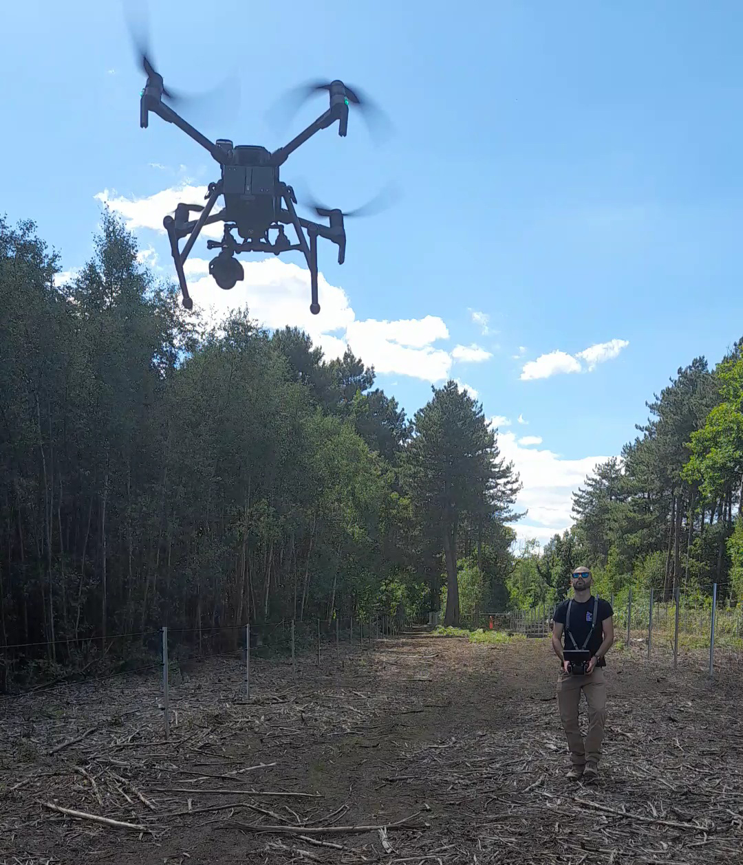
Conducting Drone Remote Sensing. Blean Wood© Lawrence Ball